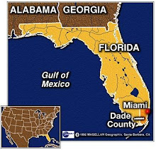
A street grid stretches from downtown Miami throughout the county. This grid was adopted by the City of Miami following World War I after the United States Post Office threatened to cease mail deliveries in the city because the original system of named streets, with names often changing every few blocks and multiple streets in the city sharing the same name, was too confusing for the mail carriers.
Although this grid is easy to understand once one is oriented to it, it is not universal in the entire county. Hialeah uses its own grid system which is entirely different in its orientation. Coral Gables and Miami Lakes use named streets almost exclusively, and various smaller municipalities such as Florida City and Homestead use their own grid system along with the Miami-Dade grid system adding to the confusion.
From http://en.wikipedia.org/wiki/Miami-Dade_County,_Florida
Tuesday, January 6, 2009
Subscribe to:
Post Comments (Atom)


No comments:
Post a Comment